
Mobile Mapping System
Oman vision 2040 focuses on building a sustainable and diversified national economy, share distribution of the development among governorates and protect national environment and resources. The continues development requires accurate and art of stat geospatial data that could be used visualization, modelling and analyzing using specific tools like Geographic Information System (GIS) to defined the problem, analysis and provide the possible solutions, where the projects and strategic planes will be implemented. This result on a continues increase in demands for an accurate and argent geospatial data and this requirement has been developed for the procurement of Mobile Mapping System (MMS).
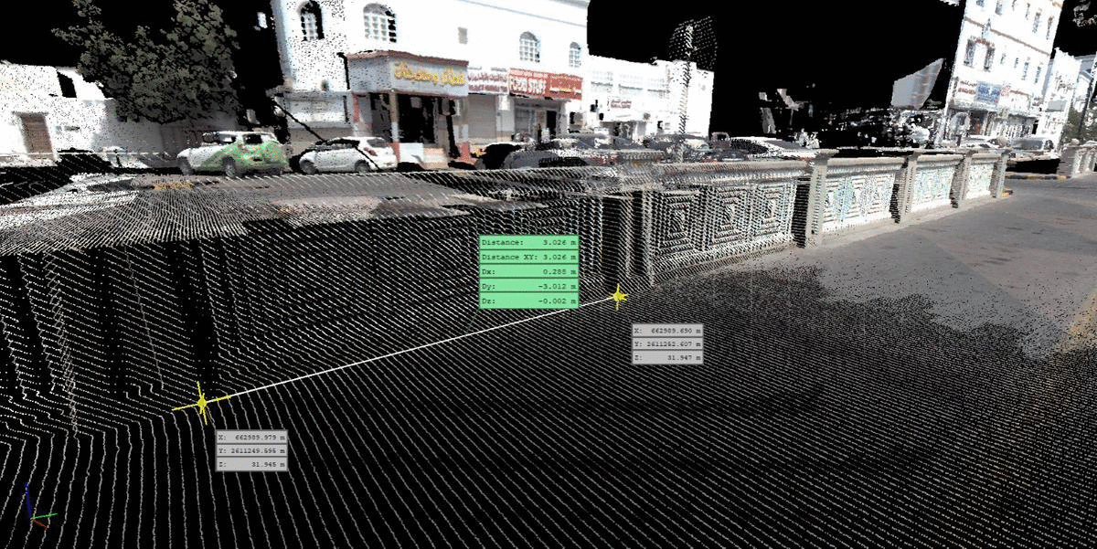
Mobile mapping is the process of collecting geospatial data from a mobile vehicle, typically fitted with a range of photographic, radar, laser, LiDAR or any number of remote sensing systems. This unit takes 360 degree photos, collects dense point clouds using fast laser scanner and observes GNSS data to get a centimeter accurate location. The primary outputs from such systems include GIS data, digital maps, and georeferenced images.
This technology will facilitate NSGIA with a quick data capture mechanism with high accuracy. The output data can provide the Sultanate with 3D City Modeling, Asset Management, Condition Assessment, Land Use, Surveying, Topographical Surveying, Volumetric Surveying, Disaster Management, Construction Monitoring, Housing/Infrastructure Mapping Open Pit Mine Surveying, and Valuations etc